Zaachila has been an active Zapotec community since about 2000 BCE. It likely began as a small farming village and remained so for most of the thousand years before Monte Alban came into existence. During that time the dominant city in the Valles Centrales was Mogote, north of present-day Oaxaca in the Etla valley. When the Zapotecs gained control of most of the region, they created Monte Alban as the political and religious center of their empire. It was only after the decline of Monte Alban sometime after 800 CE that Zaachila rose to become the political center of Zapotec authority, while Mitla became the religious center. Mixtecs encroaching from the northwest exerted ever-increasing authority, in time rivaling the Zapotec rulers. When the Spanish arrived in the early 1520’s they established their capital, Antequera, at the site of present-day Oaxaca city and the glory of Zaachila faded.
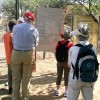
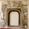
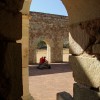
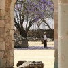
The archeological site just a block off the town center in Zaachila contains largely unexplored ruins of a palace complex. Limited excavations done in 1962 unearthed the tomb of Lord Nine Flower, which contained notable treasure. While the artifacts themselves are now on display at the National Museum of Anthropology in Mexico City and the cultural museum next to Santo Domingo church in Oaxaca, photographs of the most notable finds are displayed at the site. Visitors are able to enter the burial chambers and wander the rest of the archeological site. Visitors are advised that the archeological site is still considered sacred ground and is actively used for various rituals by some locals. Please be extremely deferential if you happen upon a shaman conducting a cleansing ceremony or other inhabitants gathered for prayers or to make offerings.
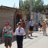
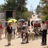
Wall art abounds in Zaachila. Many streets in the community are adorned with murals, but none more so that the street leading from the parish church to the cemetery. This is the route used by funeral processions, and many buildings along the way display remarkable examples of “Day of the Dead” art. You will definitely want your camera as we walk this way!
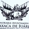
The legend of Princess Donaji is a prized part of the cultural heritage of the area. In the year 1490, King Cosijoeza of the Zapotecs married Coyollicatzin, a daughter of Ahuitzol, perhaps the mightiest of the fabled Great Speakers of the Aztecs. The couple had five children, the youngest of whom was a girl. A soothsayer consulted at her birth foretold that she would one day sacrifice herself for her people, so she was called “Donaji,” meaning “Great Soul.” In 1520, Cosijoeza rashly attacked his northern neighbors, the fierce Mixtecs, who repulsed his army in a pitched battle. Things might have gotten considerably worse for Cosijoeza, but legend has it that the Spanish, under Hernán Cortés, intervened and brokered a treaty, which required Donaji to become a hostage of the Mixtecs to guarantee peace. While a captive, Donaji acted as a spy and advised her father about the strength and tactics of the Mixtecs. Using her information, Cosijoeza knew when and how to attack his foes. He achieved a great victory — except for one thing. Outraged by the breach of the treaty, the Mixtecs decapitated Donaji and left her body on the banks of the Atoyac river, which wends through the city of Oaxaca. Tradition has it that when her body was found, a lovely violet iris was growing around her head, which had not decomposed. Ever after, the selfless Donaji was revered by the Zapotec people. Three hundred years later the city government of Oaxaca honored the heroine by placing an image of her head on the coat of arms, where it remains to the present day.
http://en.wikipedia.org/wiki/Zaachila
http://www.exploringoaxaca.com/cities-villages,oaxaca-state,zaachila-oaxaca/
Cuilapam is one of several villages near Oaxaca city which were predominantly Mixtec when the Spanish conquistador, Hernán Cortés, claimed the region as his personal fiefdom in the late 1520’s. In previous centuries it had seen its power as a chiefdom wax and wane, as political power flowed to or from Monte Alban, and between the Zapotecs and Mixtecs. It was a vibrant community of perhaps forty thousand people when the Spanish arrived. The name of the town is spelled with either a final “n” or “m.” The reason behind the two spellings is a difference in the Nahuatl suffix, with -pan meaning “place of ” and –pam meaning “valley of.” Both spellings can be seen on signs and maps and both are considered correct.
http://www.youtube.com/watch?v=uUTaD4ETVEA
http://en.wikipedia.org/wiki/Cuilapan_de_Guerrero
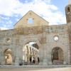
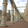
Construction of the monastery complex in Cuilapam was begun by the Dominican order in 1555. At the time, Cuilapam was a thriving city and the most important Mixtec community in the area. Antequera (as the early Oaxaca city was named), on the other hand, was just getting established. As the ruins attest, there were grand plans for the monastery complex in Cuilapam! However, circumstances prevented those dreams from ever becoming reality — chief among them the precipitous decline in the population due to resurgent epidemics of smallpox, measles, typhoid fever and a strange illness called enteric fever. It is generally agreed that the native Mexican population decreased by 90% between 1521 and 1600. In the meantime, Antequera took root and quickly became the dominant economic and political center in the Oaxaca valley. The Dominicans moved their headquarters to the convent of Santo Domingo in Antequera and the monastery complex at Cuilapam was abandoned about 1595. For hundreds of years the ruins sat undisturbed. The partially-completed conventual chapel was roofed over in 1910 and has been used as a parish church since.
Time frame: 8:00 depart Oaxaca / 9:00 arrive Zaachila / 9:15 group splits into 2 parts, each with 30-minute window to visit city market & general archeological site & museum and excavated tombs / 10:15 start hike from church courtyard / 12:30 arrive Hacienda Cuilapam for lunch / 2:00 visit monastery ruins / 2:30 leave Cuilapam / 3:00 return Oaxaca.

